Dundgovi (Дундговь)· Цагаан суварга
Tsagaan Suvarga (White Stupa)
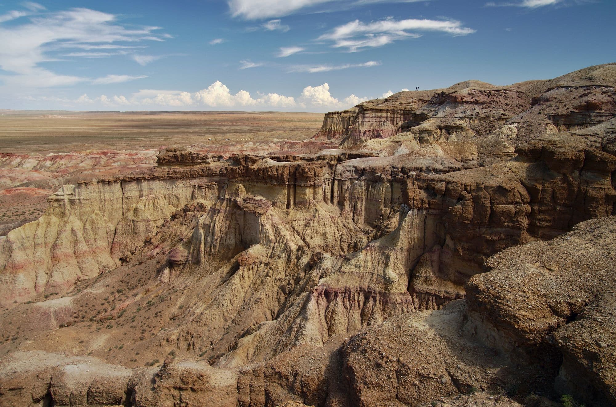
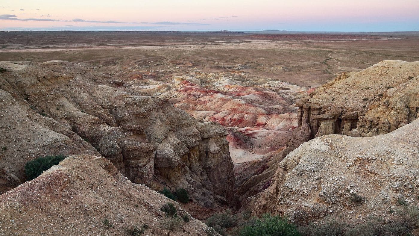
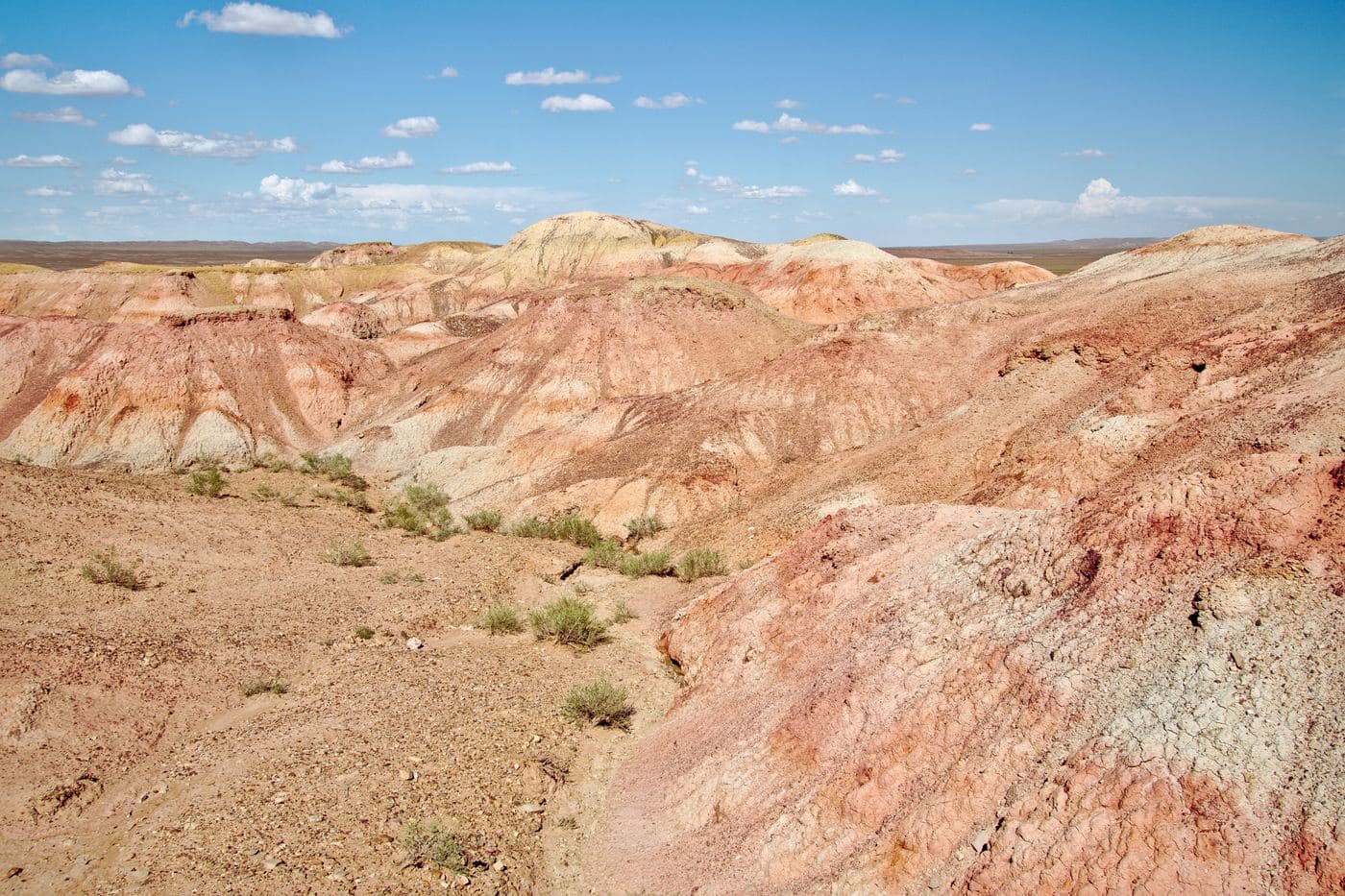
Tsagaan Suvarga is the eroded edge of an old lake-bed plateau in the south of Dundgovi, where the ground simply stops and drops away into a wall of banded sediment. Seen from the plain below, the columns and buttresses look like a row of pale stupas, which is where the Mongolian name comes from. The colours run from chalk white through pink and ochre to rust, and they shift completely between morning and late afternoon light, so most visitors time their stop for one end of the day. It is usually a half-day stop rather than a destination in itself, on the overland route between the Dundgovi sites and the deep Gobi.
- From Ulaanbaatar
- 445 km
- Drive time
- 7-9 hours
- Altitude
- 1,322 m
- Typical stay
- 0-1 nights; most itineraries arrive in the late afternoon, sleep at a nearby camp and leave after sunrise
- Best months
- May–Sep
- Jan: not a best month
- Feb: not a best month
- Mar: not a best month
- Apr: not a best month
- May: a best month
- Jun: a best month
- Jul: a best month
- Aug: a best month
- Sep: a best month
- Oct: not a best month
- Nov: not a best month
- Dec: not a best month
Highlights
- Walking the rim of the escarpment and looking down the full face of the banded cliff
- Descending the track to the foot of the wall and walking back along its base, which gives the true sense of scale
- The colour change between sunrise, midday and sunset on the same rock face
- Marine and lake sediments in the exposed layers, a reminder this was once under water
- Khevtee Bosoogiin Agui, a cave site about 6 km east of the main viewpoint
- Wide, empty horizon views from the plateau top in every direction
- Ovoo cairns on the approach track, where Mongolian travellers stop
Season notes
Late spring to early autumn is the practical window. May and early June bring strong wind and dust; July and August are hot on the exposed plateau with no shade at all; September gives the most stable light and cooler walking, but nights already drop near freezing. Winter access is possible on frozen ground but camps close and there is no shelter.
From Ulaanbaatar
Paved highway from Ulaanbaatar south to Mandalgovi, then roughly 130-150 km of gravel and graded dirt tracks. Two signed approach tracks exist, one from Ölziit and one from Tsogt-Ovoo. High clearance is needed for the last stretch and for the descent track to the cliff base.
By air
No airstrip nearby. The closest scheduled airport is Dalanzadgad (DLZ), roughly 200-250 km by road to the south-west, which is only useful if the site is added to a South Gobi itinerary rather than a Dundgovi one.
Where to stay
- Govi Caravanserai ger camp, about 2 km west of the viewpoint (mapped in OpenStreetMap); nightly rate not published
- Standard tourist ger camps in the area: roughly USD 40-70 per person per night including three meals (2026 guidance for Mongolian tourist ger camps)
- Nomad family ger homestay in the surrounding sums: roughly USD 20-40 per person per night including meals (2026)
- Wild camping is common here; there is no fixed campsite infrastructure
Be aware
Sources (4)
- OpenStreetMap - Tsagaan Suvraga attraction, viewpoint and ticket office nodes — Visitor coordinates, Mongolian and English name forms, posted ticket prices, nearby cave and ger camp, approach road names
- OpenStreetMap Nominatim - Tsagaan Suvarga — Confirming the site lies in Ölziit sum, Dundgovi aimag
- OpenTopoData SRTM 30 m elevation dataset — Rim and plain elevations and the height of the escarpment
- Discover Mongolia - Tourist ger camps — 2026 nightly price bands for standard ger camps and nomad homestays
Often combined with
Baga Gazriin Chuluu
Dundgovi · 278 km
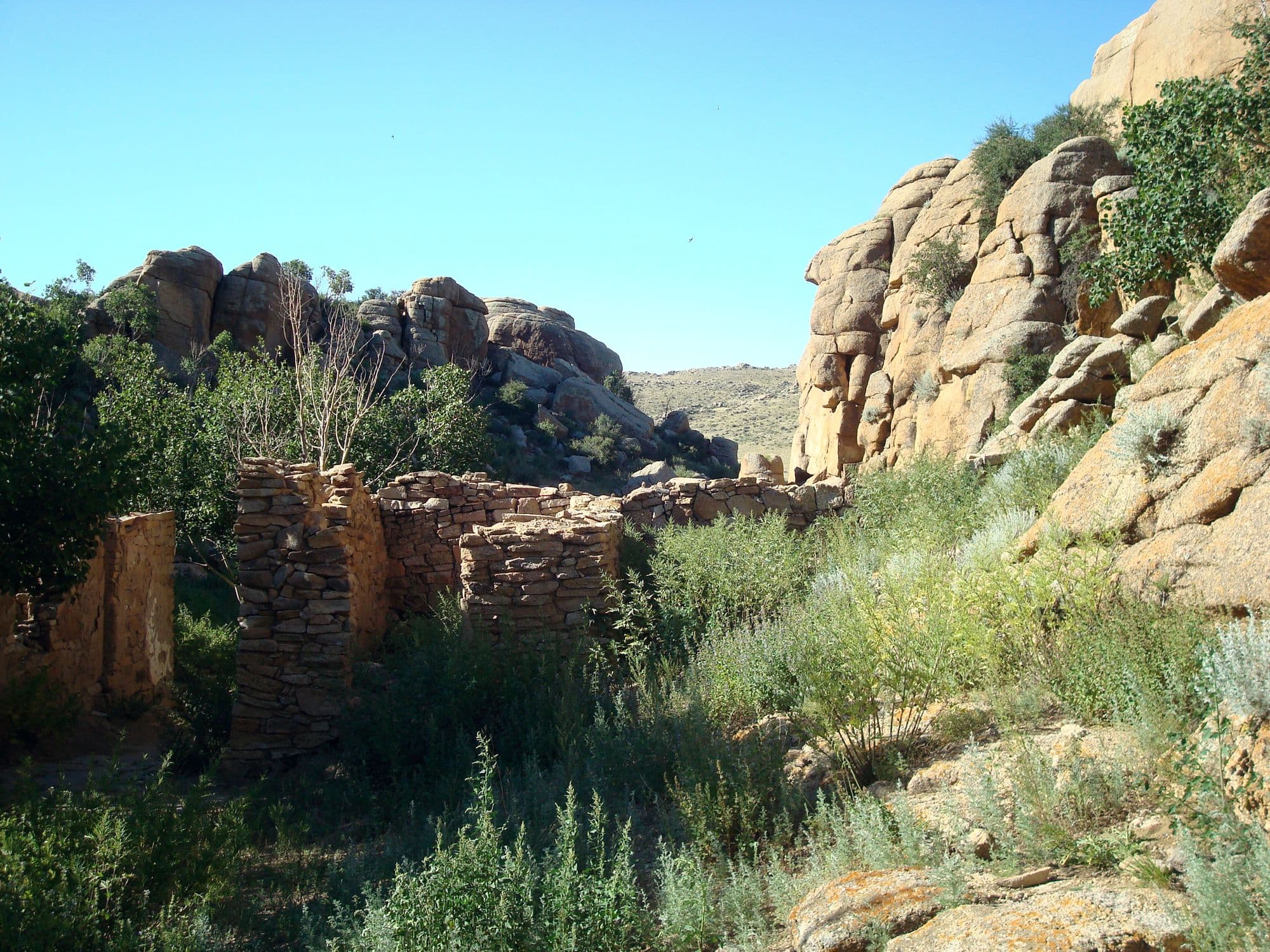
Baga Gazriin Chuluu is a granite massif standing out of the steppe in northern Dundgovi, a jumble of weathered boulders, tors and narrow rock corridors that looks nothing like the sand-and-gravel Gobi people expect. Because it is only four or five hours from Ulaanbaatar on mostly paved road, it is the usual first night on a Gobi loop and the first proper taste of the desert edge. The rocks hold the ruins of a stone temple, a cave, rock carvings and a spring that Mongolians visit for their eyes. It rewards a slow walk more than a photo stop.
- Best months
- May–Sep
Ongi Monastery (Ongiin Khiid)
Dundgovi · 528 km
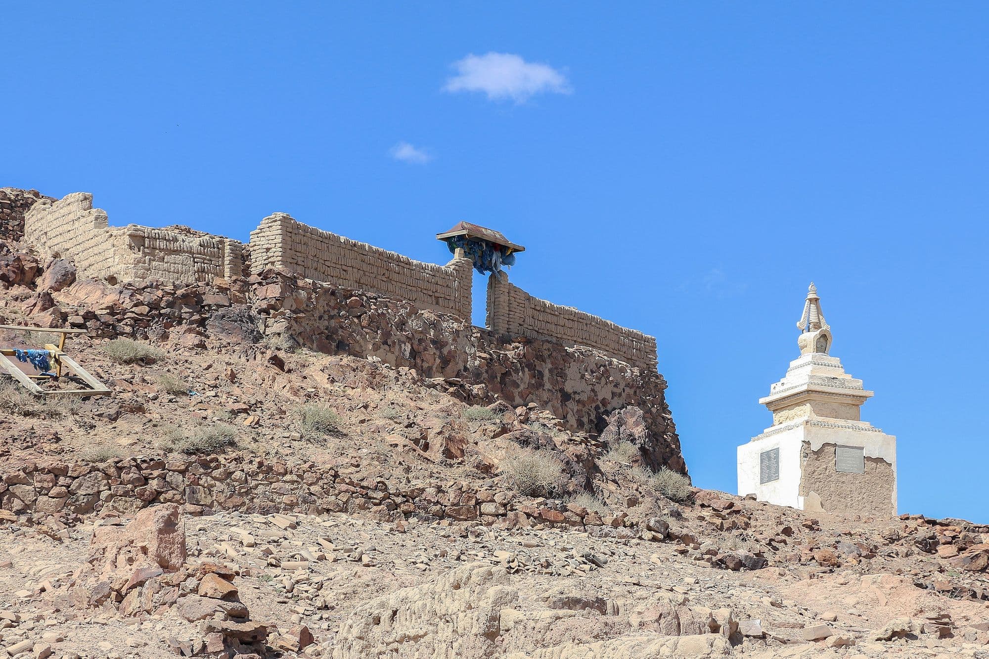
Ongi is the ruin of what was once one of the largest monastic complexes in Khalkha Mongolia, spread across both banks of the Ongi river at the foot of Saikhan-Ovoo mountain. It grew from the late 18th century into a centre of over a thousand monks with separate colleges for philosophy, tantra, medicine and mathematics, and it was destroyed in the Stalinist purges of the 1930s. What remains is a field of broken walls, foundations and standing stupas, with one small temple rebuilt since the 1990s and a handful of monks again in residence. It sits almost exactly where a Gobi loop needs a night, and the contrast between the scale of the ruins and the emptiness around them is the point.
- Best months
- May–Sep
Yolyn Am (Vulture's Gorge, often 'Eagle Valley')
Ömnögovi · 624 km
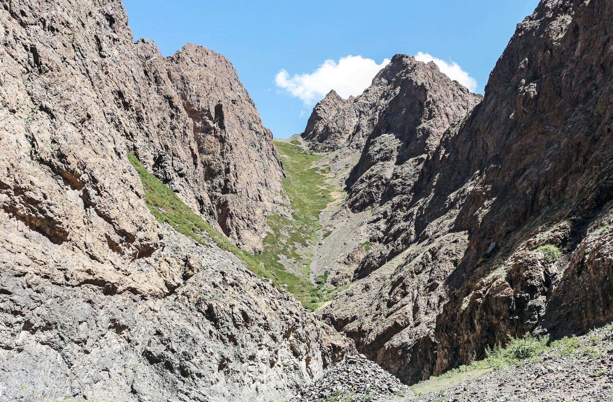
Yolyn Am is a narrow gorge cut into the Zuun Saikhan range inside Gobi Gurvansaikhan National Park, and it is the one place in the South Gobi where the desert stops feeling like desert. The walls close to a few metres apart, a stream runs along the floor, and for much of the year a sheet of ice sits in the shaded narrows. It is named after the yol, the bearded vulture that nests on the cliffs above. Visitors park at the mouth, pass a small natural history museum, and walk or ride a horse a few kilometres up the valley to the ice.
- Best months
- May–Sep
Bayanzag (the Flaming Cliffs)
Ömnögovi · 667 km
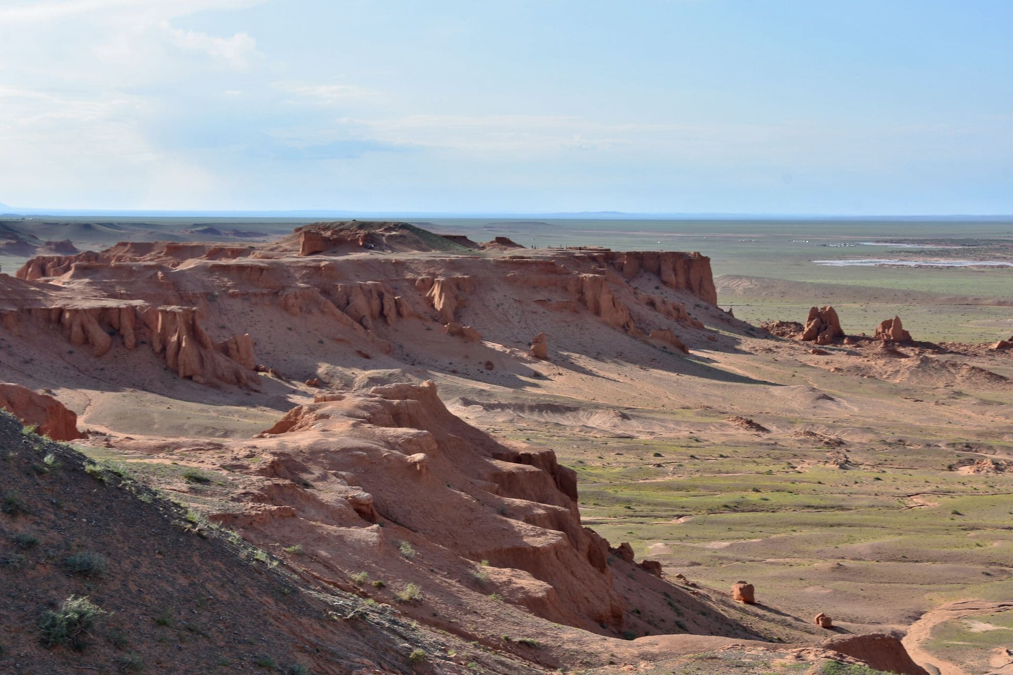
Bayanzag is a line of orange sandstone cliffs and badlands on the edge of a saxaul woodland, and it is the single most important site in the history of dinosaur palaeontology in Asia. Roy Chapman Andrews of the American Museum of Natural History named it the Flaming Cliffs in the 1920s for the colour the rock turns at sunset, and it was here that the first scientifically recognised dinosaur eggs were found. The rock belongs to the Djadochta Formation, which has also produced Velociraptor, Protoceratops, Oviraptor and some of the earliest known placental mammals. Visiting means walking the rim and the gullies below, which is a short and easy stop, and it is almost always timed for late afternoon.
- Best months
- May–Sep