Ömnögovi (Өмнөговь)· Ёлын ам
Yolyn Am (Vulture's Gorge, often 'Eagle Valley')
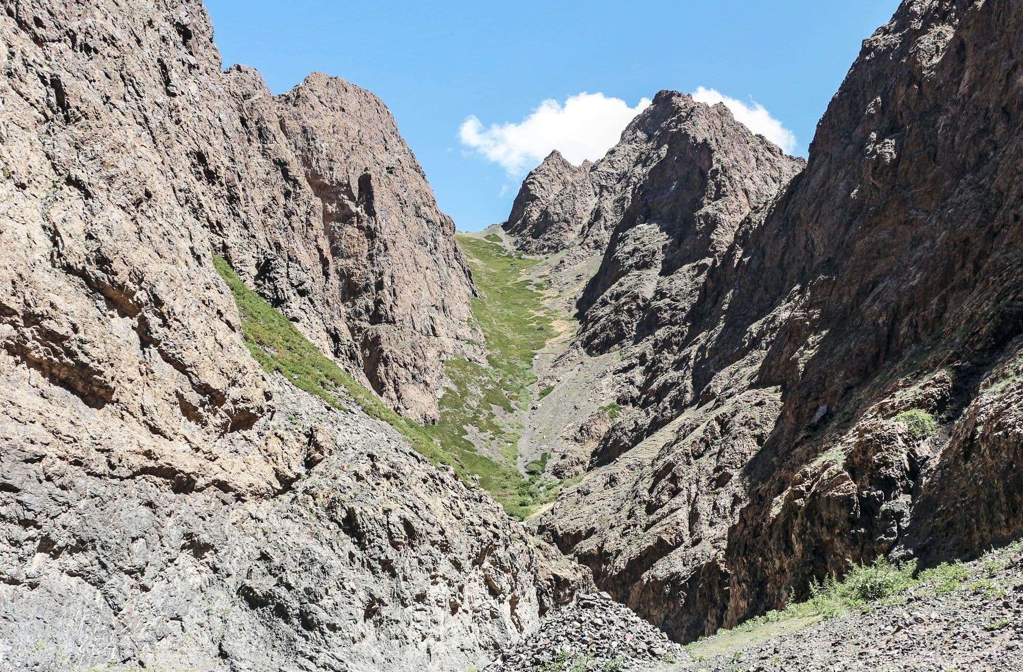
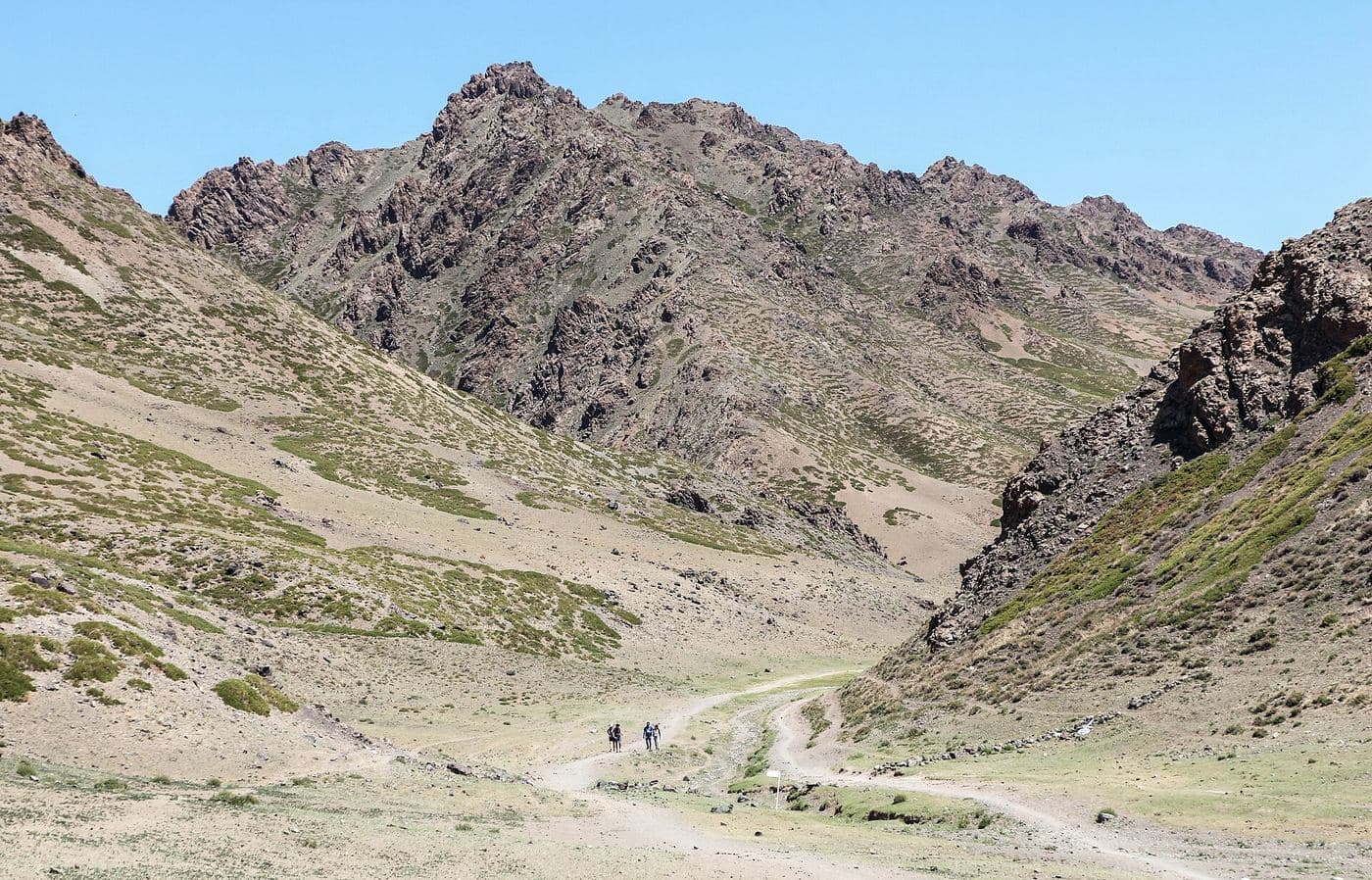
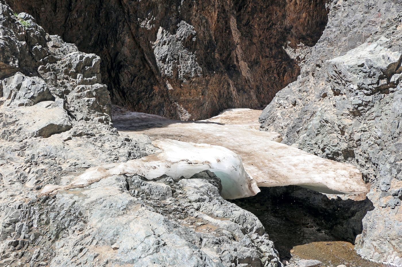
Yolyn Am is a narrow gorge cut into the Zuun Saikhan range inside Gobi Gurvansaikhan National Park, and it is the one place in the South Gobi where the desert stops feeling like desert. The walls close to a few metres apart, a stream runs along the floor, and for much of the year a sheet of ice sits in the shaded narrows. It is named after the yol, the bearded vulture that nests on the cliffs above. Visitors park at the mouth, pass a small natural history museum, and walk or ride a horse a few kilometres up the valley to the ice.
- From Ulaanbaatar
- 624 km
- Drive time
- 9-11 hours driving, normally split over two days
- Altitude
- 2,281 m
- Typical stay
- 1-2 nights at a camp in or near the Gurvan Saikhan valleys
- Best months
- May–Sep
- Jan: not a best month
- Feb: not a best month
- Mar: not a best month
- Apr: not a best month
- May: a best month
- Jun: a best month
- Jul: a best month
- Aug: a best month
- Sep: a best month
- Oct: not a best month
- Nov: not a best month
- Dec: not a best month
Highlights
- The ice field in the narrows, sometimes metres thick, surviving into midsummer at 2,200-2,400 m
- The walk up the gorge from the car park to where the walls squeeze together
- Bearded vultures (yol) and other raptors riding the thermals above the cliffs
- Siberian ibex and argali sheep on the slopes, often visible with binoculars
- Small natural history museum at the valley mouth with local fossils and stuffed fauna
- Pika and marmot colonies along the stream banks
- Horse riding from the car park up the valley
- Mukhar Shivert, a side valley a few kilometres east, usually visited on the same day
Season notes
If the ice is the point, come May to early July - it now usually melts out by late July or August, and September snow cover has become unreliable as the climate warms. July and August are the greenest and busiest. At over 2,200 m the gorge is cold and windy even in summer, and there can be snow showers in May and September. Winter visits are spectacular but need real cold-weather gear.
From Ulaanbaatar
Paved highway the whole way from Ulaanbaatar via Mandalgovi to Dalanzadgad, then a paved road from Dalanzadgad towards the park, with the last few kilometres to the car park on gravel. This is one of the easiest deep-Gobi sites to reach by road.
By air
Dalanzadgad Airport (DLZ) has scheduled domestic flights from Ulaanbaatar and the only paved runway in Ömnögovi; from the airport the gorge is roughly a 1-hour drive. Flying in and driving out is a common way to cut a day of road time.
Where to stay
- Ger camps in the Dund Saikhan and Mukhar Shivert valleys, 5-20 km from the gorge mouth (several mapped in OpenStreetMap, including a Mukhar Shivert camp)
- Standard tourist ger camp: roughly USD 40-70 per person per night including three meals (2026)
- En-suite or deluxe ger camp: roughly USD 80-150 per person per night including meals (2026)
- Hotels and guesthouses in Dalanzadgad (population about 32,700 in 2024) for anyone wanting a solid building and a hot shower
Be aware
Sources (7)
- Ёлын ам - Mongolian Wikipedia — Mongolian name, 45 km from Dalanzadgad and 650 km from Ulaanbaatar, 64 km2 protected core, average elevation, naming after the yol bird, and the recent loss of year-round ice
- Gobi Gurvansaikhan National Park - Wikipedia — Park area, 1993 establishment and 2000 expansion, paved road from Dalanzadgad, wildlife list
- Gurvan Saikhan Mountains - Wikipedia — The three subranges, the 2,825 m high point, and Yolyn Am's position in Zuun Saikhany Nuruu
- Dalanzadgad - Wikipedia — Distance south of Ulaanbaatar, town elevation and 2024 population
- ウムヌゴビ県 - Japanese Wikipedia — Dalanzadgad Airport being the only paved runway in the province with scheduled Ulaanbaatar flights; Japanese province and town names
- Discover Mongolia - Top 10 destinations — Ice persisting into July and melting out by late July or August
- OpenStreetMap - Yolyn Am gorge, drive and Mukhar Shivert — Gorge coordinates, the approach drive, the Mukhar Shivert side valley and nearby ger camps
Often combined with
Khongoryn Els (the Singing Dunes)
Ömnögovi · 838 km
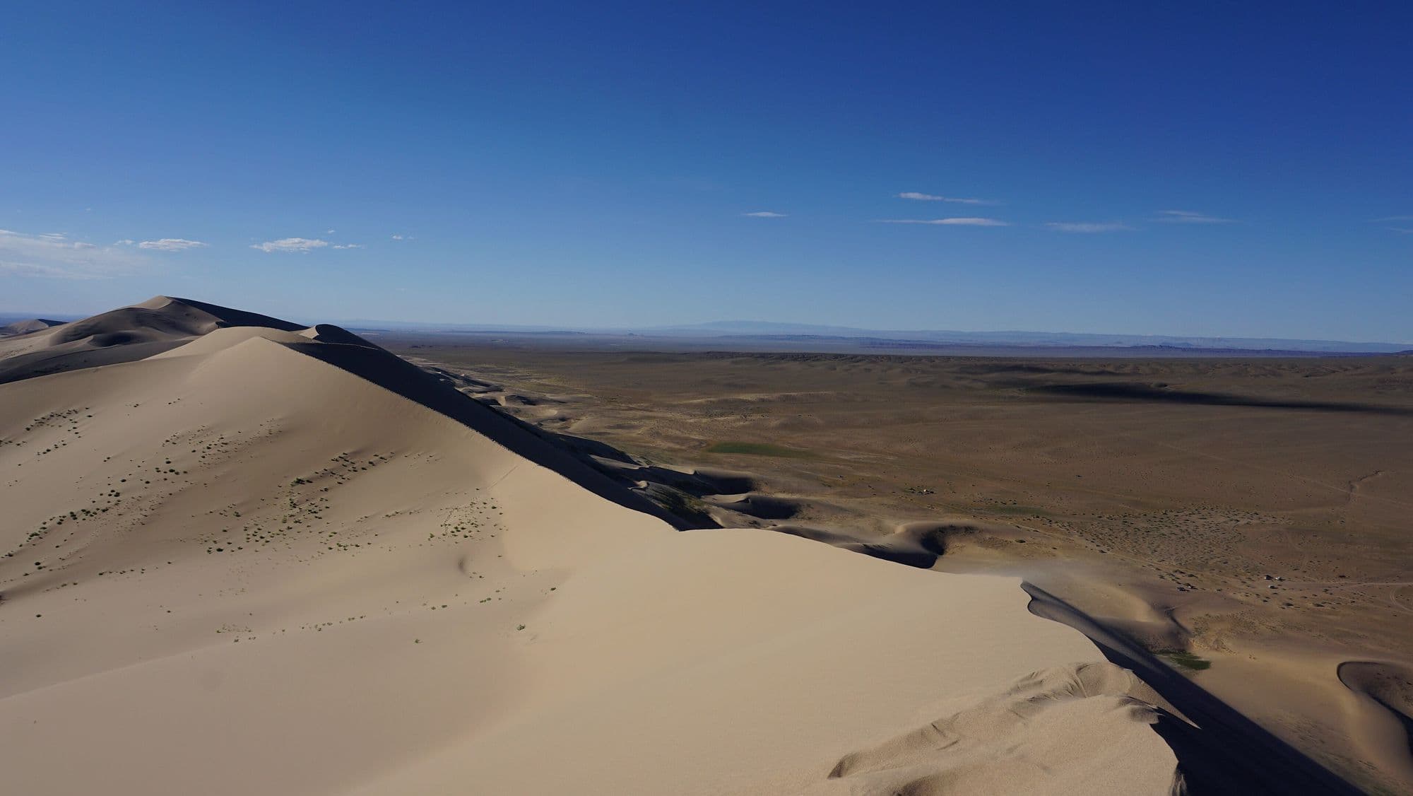
Khongoryn Els is the largest dune field in Mongolia, a band of sand running along the back of the Sevrei and Zöölön ranges with crests that rise as much as 300 m above the plain. Its nickname comes from the low droning hum the sand makes as grains slide and rub against each other on a windy day. The contrast is what makes it: bare rock mountains to the south, a wall of sand in the middle, and on the north side a green ribbon of oasis where the Khongoryn Gol stream surfaces and nomad families graze camels. Climbing the high dune for sunset is the standard reason people come, and it is much harder work than it looks.
- Best months
- Jun–Sep
Bayanzag (the Flaming Cliffs)
Ömnögovi · 667 km
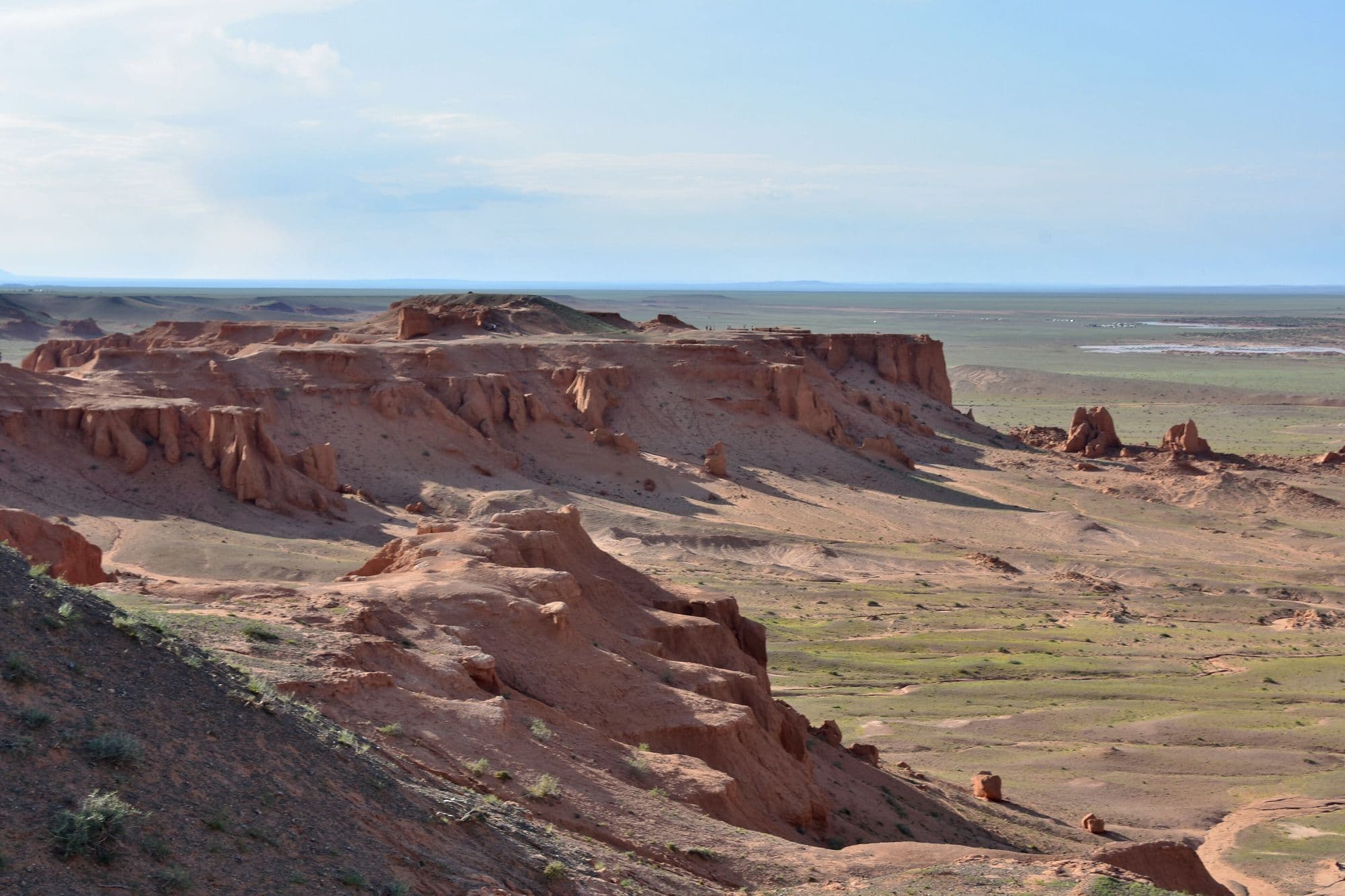
Bayanzag is a line of orange sandstone cliffs and badlands on the edge of a saxaul woodland, and it is the single most important site in the history of dinosaur palaeontology in Asia. Roy Chapman Andrews of the American Museum of Natural History named it the Flaming Cliffs in the 1920s for the colour the rock turns at sunset, and it was here that the first scientifically recognised dinosaur eggs were found. The rock belongs to the Djadochta Formation, which has also produced Velociraptor, Protoceratops, Oviraptor and some of the earliest known placental mammals. Visiting means walking the rim and the gullies below, which is a short and easy stop, and it is almost always timed for late afternoon.
- Best months
- May–Sep
Khermen Tsav
Ömnögovi · 1,029 km
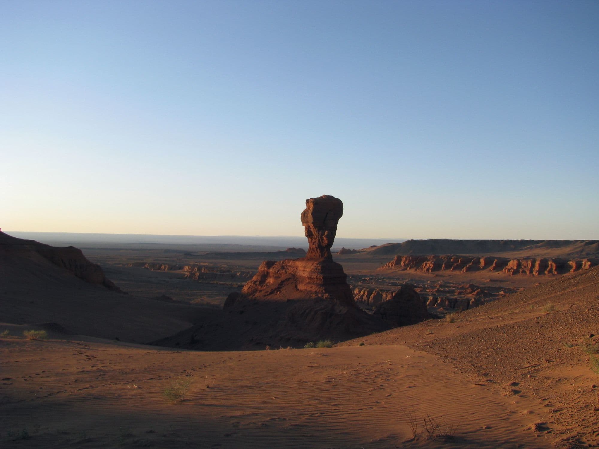
Khermen Tsav is a deep red canyon system cut into the far western Gobi, a maze of eroded sandstone walls, towers and spurs that Russian-speaking visitors nicknamed the Mongolian sphinxes. It is one of the richest Late Cretaceous fossil localities anywhere, the reference area for the Hermiin Tsav beds of the Barun Goyot Formation, and the sandstone preserves an ancient landscape that was itself a dune field. Almost nobody gets here: it is hundreds of kilometres of desert track from the nearest paved road, with no settlement, no fuel and no mobile signal. That remoteness is exactly why serious photographers and expedition travellers make the effort.
- Best months
- May–Jun, Sep
Tsagaan Suvarga (White Stupa)
Dundgovi · 445 km
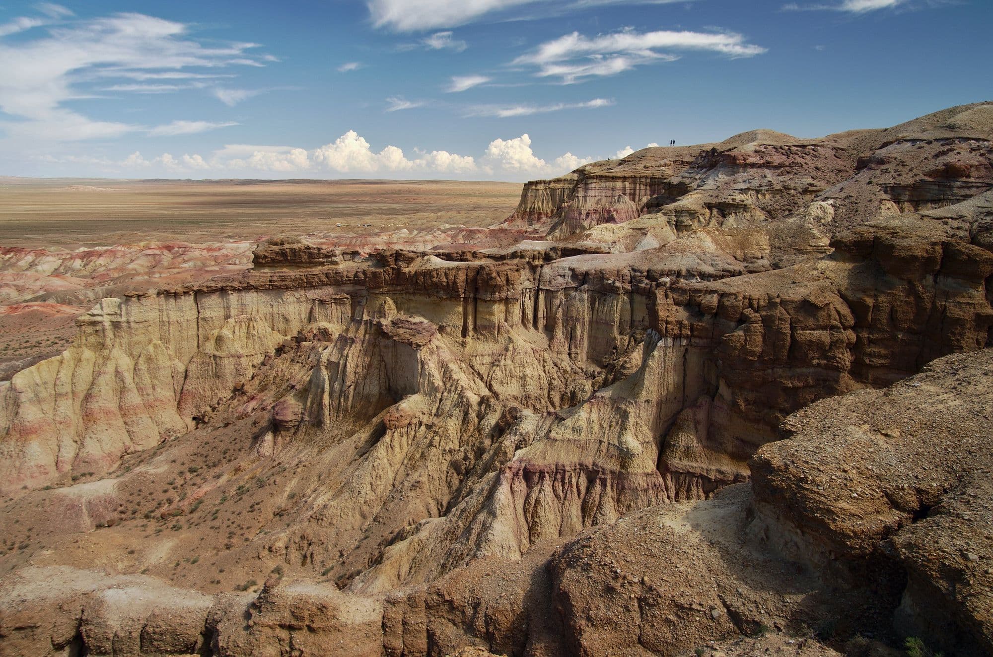
Tsagaan Suvarga is the eroded edge of an old lake-bed plateau in the south of Dundgovi, where the ground simply stops and drops away into a wall of banded sediment. Seen from the plain below, the columns and buttresses look like a row of pale stupas, which is where the Mongolian name comes from. The colours run from chalk white through pink and ochre to rust, and they shift completely between morning and late afternoon light, so most visitors time their stop for one end of the day. It is usually a half-day stop rather than a destination in itself, on the overland route between the Dundgovi sites and the deep Gobi.
- Best months
- May–Sep